Rights of Way (Footpaths, bridleways, restricted byways and byways open to all traffic)
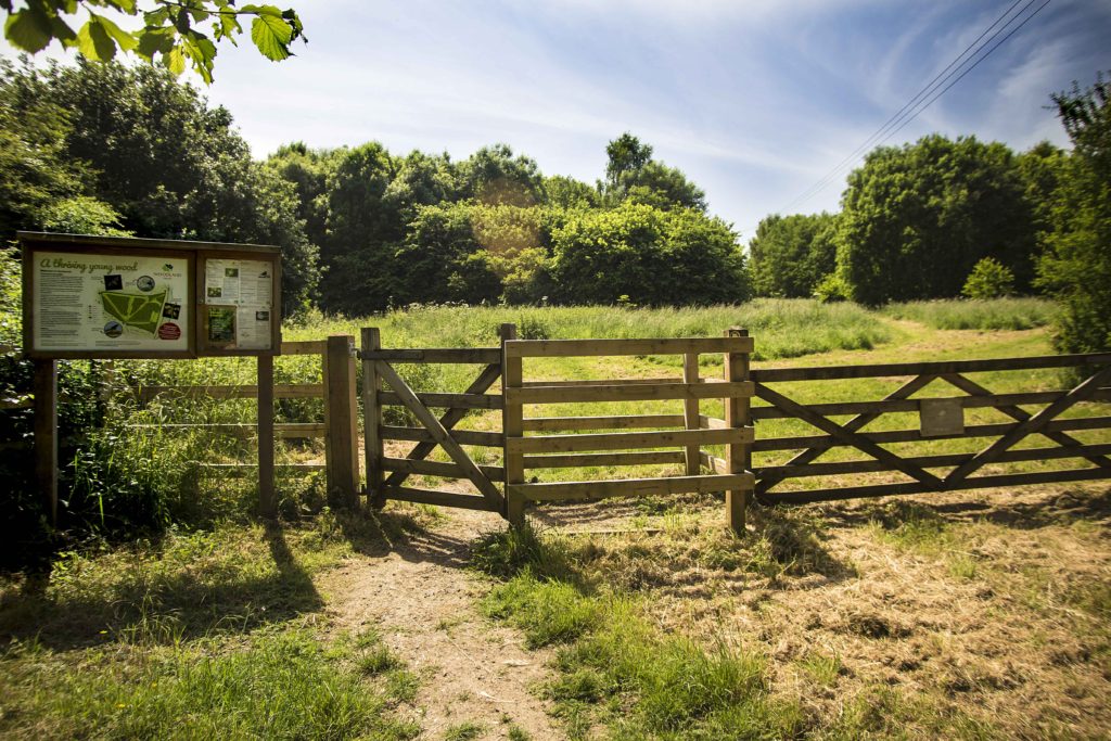
The Parish Council is keen to encourage people to use the network of Rights of Way that exist throughout the area. It is supporting the newly formed Yetminster & Ryme Intrinseca Walking Group (Y&RIWG) in developing a strategy to try to improve these with a view to first classifying them in terms of their condition and accessibility prior to their improvement where necessary. It is also hoped to appoint a Footpaths Liaison Officer to co-ordinate subsequent maintenance and improvements with the Ranger Service.
The initiative is in its early stages but information is needed to establish a base so that things can move forward. If you do walk one of the Rights of Way please identify the reference using the maps below and send your “report” on the conditions found to the walking group by emailing yetpaths@gmail.com or by using the Contact Form on the Parish Website main header bar. It would also be helpful if you could provide the complaint reference number (if you do report a problem to the Ranger Service), and your name and contact details, and also indicate if would like to join or help the walking group.
Further information on the Walking Group, including walk dates, can be found in the Clubs and Societies pages under the “Amenities” heading on the main panel and by clicking here
The Dorset Rights of Way Improvement Plan can be viewed by clicking here
We are very grateful to the local Y&RIWG who have mapped the following routes. Click on the route to open an Alltrails map.
Parish Boundary 17.5km
Yetminster, Hamlet, Ryme Intrinseca 13.1km
Yetminster, Winterhayes, Herbury Lane 6.5km
Yetminster railway line loop 3.75km
Yetminster, Woodville Lane, Winterhayes, Millennium Wood 5.25km
Yetminster, Winterhayes, Woodville Lane 5.2km
Yetminster, Woodville Lane, Caswell 5.4km
Yetminster, Ryme Intrinseca, Caswell 5km
Yetminster, Ryme Intrinseca, Trill Lane, Folly Farm 5.65km
Yetminster, Ryme Intrinseca 3km
Yetminster, Mill Lane, Herbury Lane 2.5km
If you find a particular problem contact the Ranger Service by clicking this link here
The spreadsheet used to list reported problems with Rights of Way has been suspended. This information can now be found on Dorset Council’s “Explorer” interactive Rights of Way Map (see below)
Click here to access the OS map showing our Rights of Way
Click here to access the more detailed Dorset Council’s “Explorer” interactive Rights of Way map
Drag the map around and enlarge the area you want to look at;
On the tabs on the RHS select “layers” (3rd tab down);
Use the slider bar on the displayed menu to page down to “Countryside”;
In the Countryside sub-menu select “Problem Reports”;
From the further menu select either “Recent Problem Report” or the year you are interested in;
A series of coloured “Stars” will appear on the map – clicking on a particular star will bring up the report details and the status
Legend for Stars: Green = resolved or duplicated; Amber = under investigation / requires further investigation; Red = Received; Blue = annual maintenance; Black = timed out
NB: – click on the footpath to reveal the reference etc. for reporting a problem
When considering using a Right of Way it is important to be aware of what rights you do and don’t have –
Footpath – the green dashed line (on OS Explorer Maps) or pink dashed line (on OS Landranger Maps) are footpaths with public right of way. They are legally protected routes that the public can travel along by foot. The local authorities hold and maintain the definitive map of Rights of Way. These are the legal documents for the status and alignment of Rights of Way. Local Authorities pass details of amendments to the definitive map to Ordnance Survey for inclusion in our maps. Footpaths may cross private land and in such cases the footpath must be kept to, the public only have the right to walk along the footpath. If a landowner wishes to divert a public right of way, they must obtain a legal order from the local authorities to amend the definitive map. Footpaths are sign posted, usually with yellow or green arrows.
Bridleway – as with footpaths the bridleways (as shown in the legend above) are legally protected routes that the public can use on foot or on horseback. Cyclists are permitted to use the bridleways – although through the Countryside Act 1968 there is no obligation to facilitate the cyclists on the routes and they must give way to other users. Bridleways are usually sign posted with blue arrows.
Byway open to all traffic – these are open to all forms of traffic – pedestrians, horse riders, cyclists and car and other motor vehicle drivers. These routes are often marked with red arrows.
Restricted byway – on these routes there are restrictions on how you can travel the route. You are permitted to use the route on foot, horseback, bicycle or horse drawn carriage. You cannot use any motorised vehicles along this route.
Other public access route – these are routes that are rights of way, however the exact nature of the routes are unclear and are based on the best information that is available to hand. Prior to setting out on one of these routes – you may want to contact the local highway authority to see if they can advise on any restrictions that there may be.
Recreational route – these are routes created by Local Authorities, Government Agencies or volunteer organisations. They mainly follow existing rights of way and are waymarked, usually by whichever organisation created the route. If the route is also an existing right of way it will be maintained by a local authority. Any sections not part of existing rights of way may be maintained by the creating organisation. Local Authorities give OS permission to show these routes, but they may not actively promote the routes or give them priority over other rights of way.
National Trail / Long distance route – these are long distance routes. Some are only available for walkers, others may also be open to cyclists and horse riders. They are maintained through funding from Natural England and are sign posted along the route. Each route has a National Trails Officer who is responsible for the coordination of maintenance, improvement and promotion of the route on the ground.
Permissive footpath – this footpath takes you over private land and isn’t a right of way. The landowner has granted permission for the route to be used by the public, but they also have the right to withdraw that permission if they choose. The path will often be closed for one day a year in order to protect the landowner against any future claims of continuous public right of way. The date(s) the path is closed for should be well signed in the area.
Permissive bridleway – as with the permissive footpath above, the route takes you across private land where the landowner has granted permission for the public to use it. They do have the right to withdraw their permission and as above, will probably close the bridleway for one day a year.
If you are out and about always stick to the Countryside Code so that you can enjoy, respect and protect our countryside – clink the link to read the code – Countryside Code
Maintenance of rights of way1 – Working closely with landowners and volunteers, Dorset Council’s Greenspace Management Teams investigate reports received from members of the public and user groups and carry out practical work across the county.
Signposting and waymarking – Dorset Council has a duty to signpost public rights of way where they leave a metalled road. Rights of way are also signposted or waymarked particularly where the route is not obvious.
Stiles and gates -It is the landowner’s responsibility to maintain stiles or gates on public rights of way on their land. Dorset Council usually contributes a minimum of 25% of costs.
Obstruction -It is an offence to intentionally obstruct a public right of way.
Ploughing and cropping -Crossfield paths may be ploughed or cropped as long as the path is reinstated within 14 days. Headland paths should not be ploughed or cropped.
Overgrown vegetation -Landowners are responsible for cutting back hedges, trees or shrubs overhanging a public right of way. Surface vegetation or undergrowth on rights of way, such as nettles or brambles, are the responsibility of Dorset Council.
Bulls -Section 59 of the Wildlife & Countryside Act 1981 bans the keeping of bulls in fields crossed by a right of way, unless they are under the age of 10 months or not of a recognised dairy breed, provided they’re accompanied by cows or heifers (young female cows).
Bridges -Bridges should be in a safe condition for public use. Not all bridges on public rights of way are owned by Dorset Council, however regardless of ownership, we have a duty of care to ensure that all bridges associated with public rights of way are in a safe condition. Generally, we maintain bridges over natural watercourses. Although there are exceptions, privately-owned bridges have a higher private right i.e. private drives and access tracks. Larger bridges over man-made obstacles such as railway lines are usually the responsibility of a third party such as Network Rail.
Surface -Dorset Council is responsible for the maintenance of the surface of rights of way according to the status of the path; for example, a footpath will be maintained up to footpath standard even if it may also be used by private vehicles.
1. A right of way is a path that anyone has the legal right to use on foot, and sometimes other modes of transport: